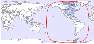
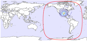
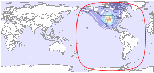
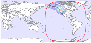
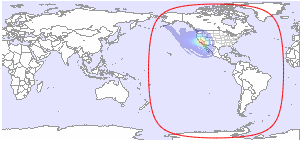
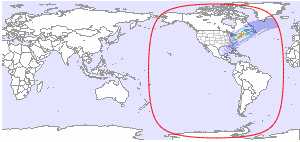
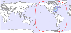
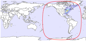
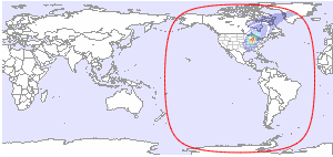
Below you will find available downlink footprint maps for T9S at 101.1°W. Click on a map for more details. If you would like to have more technical information about TV and radio channels available on T9S, please click here.
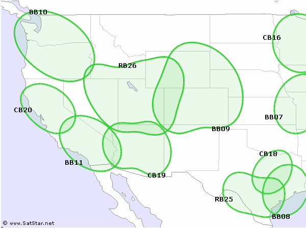
Coverage Patterns 1
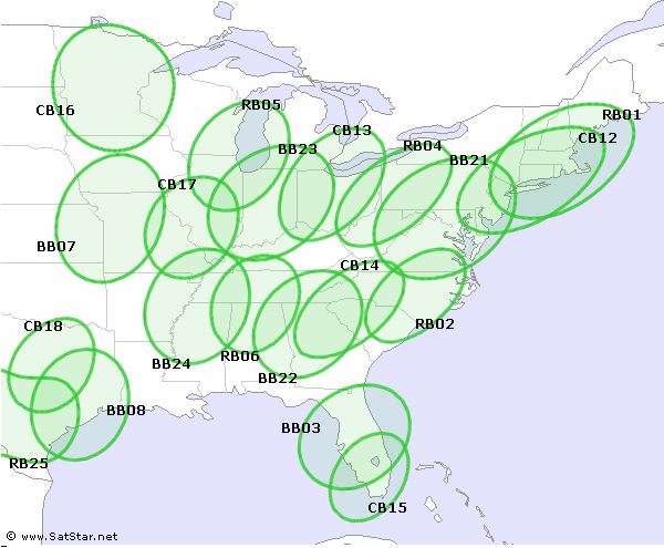
Coverage Patterns 2
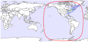
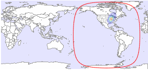
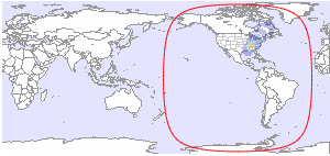
| CONUS L/R | BB03 - Orlando L |
 |
 |
| Ku-band | Ku-band |
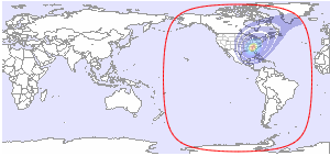
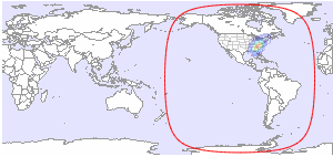
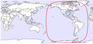
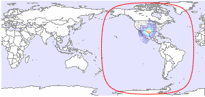
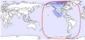
| BB07 - Kansas City L | BB08 - Houston L |
 |
 |
| Ku-band | Ku-band |
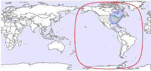
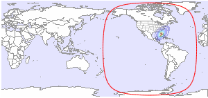
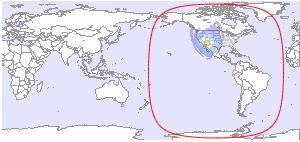
| BB09 - Denver L | BB10 - Portland L |
 |
 |
| Ku-band | Ku-band |
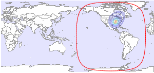
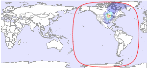
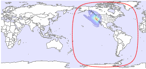
| BB11 - Los Angeles L | BB21 - Washington L |
 |
 |
| Ku-band | Ku-band |
| BB22 - Atlanta L | BB23 - Indianapolis L |
 |
 |
| Ku-band | Ku-band |
| BB24 - Memphis L | CB12 - New York L |
 |
 |
| Ku-band | Ku-band |
| CB13 - Detroit L | CB14 - Charlotte L |
 |
 |
| Ku-band | Ku-band |
| CB15 - Miami L | CB16 - Minneapolis L |
 |
 |
| Ku-band | Ku-band |
| CB17 - St Louis L | CB18 - Dallas L |
 |
 |
| Ku-band | Ku-band |
| CB19 - Phoenix L | CB20 - San Francisco L |
 |
 |
| Ku-band | Ku-band |
| RB01 - Boston L | RB02 - Raleigh L |
 |
 |
| Ku-band | Ku-band |
| RB04 - Pittsburg L | RB05 - Chicago L |
 |
 |
| Ku-band | Ku-band |
| RB06 - Nashville L | RB25 - San Antonio L |
 |
 |
| Ku-band | Ku-band |
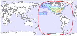
| RB26 - Salt Lake City L | DL1 (Tuscon) L |
 |
 |
| Ku-band | Ka-band |
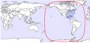
| DL2 (Minneapolis) R | |
 |
|
| Ka-band | |


and TV guide data from the internet
SatStar can provide detailed technical information about commercial geostationary satellites. It can be used by professionals, e.g. for budget link calculations, and can easily be integrated into custom applications.
All data can be stored in a database, including downlink and uplink coverage maps, frequency plans, transmissions, TV/radio channels etc. For more information, please refer to the Satellite Data page.
