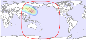
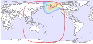
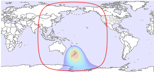
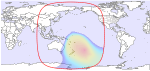
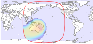
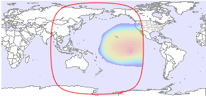
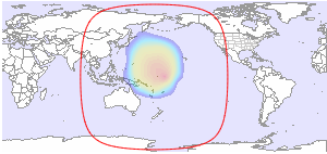
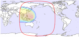
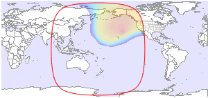
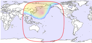
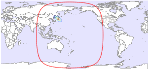
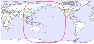
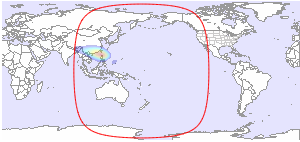
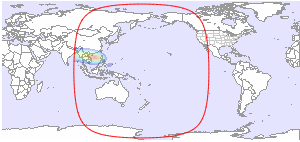
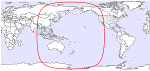
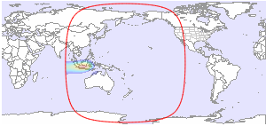
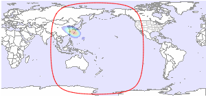
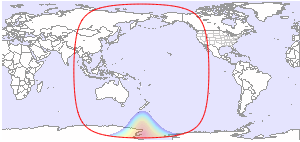
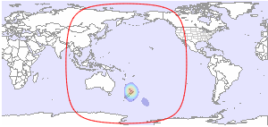
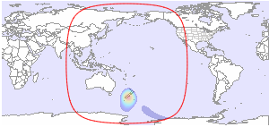
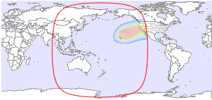
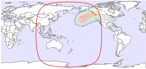
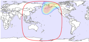
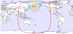
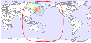
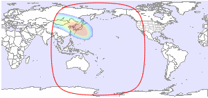
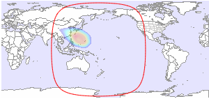
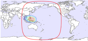
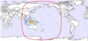
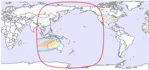
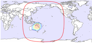
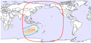
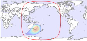
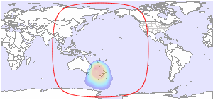
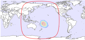
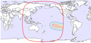
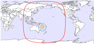
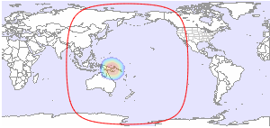
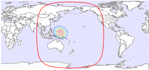
Below you will find available downlink footprint maps for Horizons 3e at 169.0°E. Click on a map for more details. If you would like to have more technical information about TV and radio channels available on Horizons 3e, please click here.
Coverage Patterns 1
Coverage Patterns 2
Coverage Patterns 3
Coverage Patterns 4
Coverage Patterns 5
| Global L | Global R |
 |
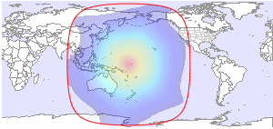 |
| C-band | C-band |
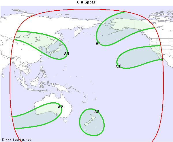
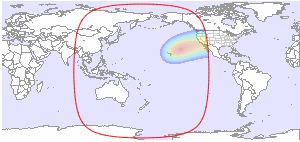
| A Gateway Spot 1 (C601) H/V | A Gateway Spot 2 (C602) H/V |
 |
 |
| C-band | C-band |
| A Gateway Spot 3 (C603) H/V | A Spot 4 H/V |
 |
 |
| C-band | C-band |
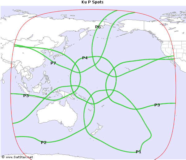
| A Gateway Spot 5 (C604) H/V | P User Spot 1 (K51) H/V |
 |
 |
| C-band | Ku-band |
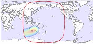
| P User Spot 2 (K52) H/V | P User Spot 3 (K53) H/V |
 |
 |
| Ku-band | Ku-band |
| P User Spot 4 (K54) H/V | P User Spot 5 (K55) H/V |
 |
 |
| Ku-band | Ku-band |
| P User Spot 6 (K56) H/V | P User Spot 7 (K57) H/V |
 |
 |
| Ku-band | Ku-band |
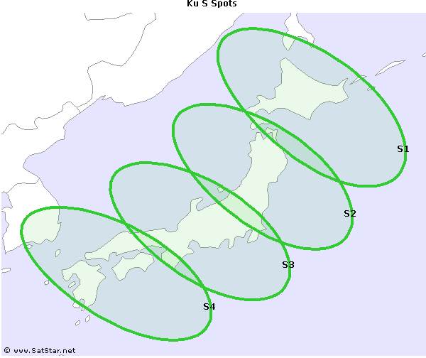
| S Spot 1 H/V | S Spot 2 H/V |
 |
 |
| Ku-band | Ku-band |
| S Spot 3 H/V | S Spot 4 H/V |
 |
 |
| Ku-band | Ku-band |
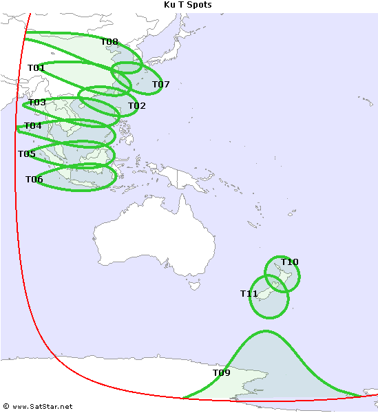
| T User Spot 01 (K11) H/V | T User Spot 02 (K12) H/V |
 |
 |
| Ku-band | Ku-band |
| T User Spot 03 (K13) H/V | T User Spot 04 (K14) H/V |
 |
 |
| Ku-band | Ku-band |
| T User/Gateway Spot 05 (K15/K605) H/V | T User Spot 06 (K16) H/V |
 |
 |
| Ku-band | Ku-band |
| T User Spot 07 (K17) H/V | T User Spot 08 (K18) H/V |
 |
 |
| Ku-band | Ku-band |
| T User Spot 09 (K19) H/V | T User Spot 10 (K20) H/V |
 |
 |
| Ku-band | Ku-band |
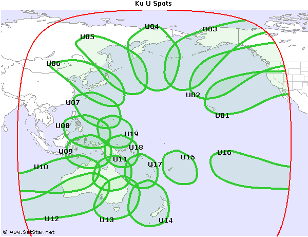
| T User Spot 11 (K21) H/V | U User/Gateway Spot 01 (K31/K601) H/V |
 |
 |
| Ku-band | Ku-band |
| U User Spot 02 (K32) H/V | U User Spot 03 (K33) H/V |
 |
 |
| Ku-band | Ku-band |
| U User Spot 04 (K34) H/V | U User Spot 05 (K35) H/V |
 |
 |
| Ku-band | Ku-band |
| U User/Gateway Spot 06 (K36/K603) H/V | U User Spot 07 (K37) H/V |
 |
 |
| Ku-band | Ku-band |
| U User Spot 08 (K38) H/V | U User Spot 09 (K39) H/V |
 |
 |
| Ku-band | Ku-band |
| U User Spot 10 (K40) H/V | U User Spot 11 (K41) H/V |
 |
 |
| Ku-band | Ku-band |
| U User/Gateway Spot 12 (K42/K602) H/V | U User/Gateway Spot 13 (K43/K604) H/V |
 |
 |
| Ku-band | Ku-band |
| U User Spot 14 (K44) H/V | U User Spot 15 (K45) H/V |
 |
 |
| Ku-band | Ku-band |
| U User Spot 16 (K46) H/V | U User Spot 17 (K47) H/V |
 |
 |
| Ku-band | Ku-band |
| U User Spot 18 (K48) H/V | U User Spot 19 (K49) H/V |
 |
 |
| Ku-band | Ku-band |


and TV guide data from the internet
SatStar can provide detailed technical information about commercial geostationary satellites. It can be used by professionals, e.g. for budget link calculations, and can easily be integrated into custom applications.
All data can be stored in a database, including downlink and uplink coverage maps, frequency plans, transmissions, TV/radio channels etc. For more information, please refer to the Satellite Data page.
