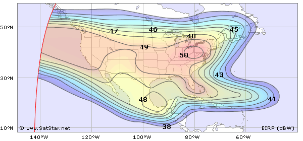
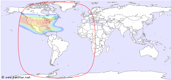
The North America H/V beam is available on Amazonas 3 at 61.0°W. If you would like to have more technical information about TV and radio channels available on Amazonas 3 at 61.0°W, please click here. All EIRP values are based on official information from the satellite owner. Some signals can have either higher or lower EIRP values than indicated below. All dish sizes are approximate.
If you complete the BeamFinder Setup, your position will be indicated in the maps below.
 |
| Dish Size Estimate (Ku-band) | ||||||||||||||||||||||||
| EIRP (dBW) | <30 | 30 | 31 | 32 | 33 | 34 | 35 | 36 | 37 | 38 | 39 | 40 | 41 | 42 | 43 | 44 | 45 | 46 | 47 | 48 | 49 | 50 | >50 | |
| Min (cm) | >535 | 475 | 425 | 380 | 335 | 300 | 270 | 240 | 215 | 190 | 170 | 150 | 135 | 120 | 105 | 95 | 85 | 75 | 65 | 60 | 55 | 50 | 50 | |
| Max (cm) | 600 | 535 | 475 | 425 | 380 | 335 | 300 | 270 | 240 | 215 | 190 | 170 | 150 | 135 | 120 | 105 | 95 | 85 | 75 | 65 | 60 | |||
Global View
 |


and TV guide data from the internet
SatStar can provide detailed technical information about commercial geostationary satellites. It can be used by professionals, e.g. for budget link calculations, and can easily be integrated into custom applications.
All data can be stored in a database, including downlink and uplink coverage maps, frequency plans, transmissions, TV/radio channels etc. For more information, please refer to the Satellite Data page.
