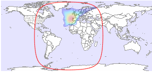
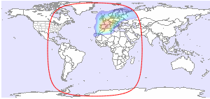
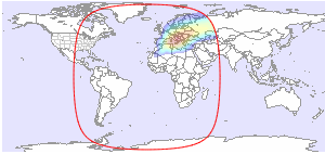
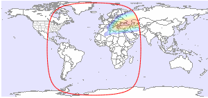
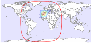
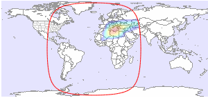
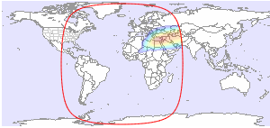
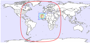
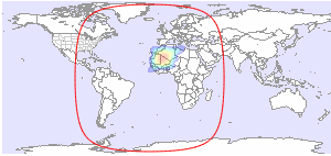
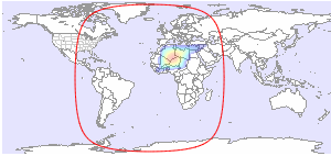
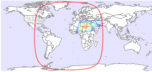
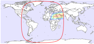
Below you will find available downlink footprint maps for Intelsat 37e at 18.0°W. Click on a map for more details. If you would like to have more technical information about TV and radio channels available on Intelsat 37e, please click here.
Coverage Patterns 1
Coverage Patterns 2
Coverage Patterns 3
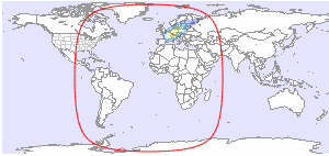
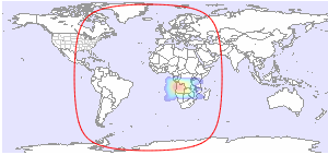
| Global L | Global R |
 |
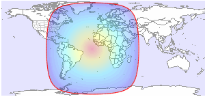 |
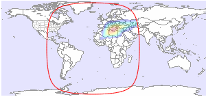
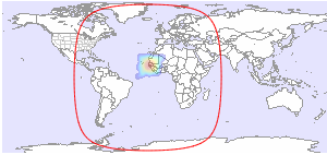
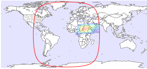
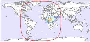
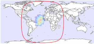
| C-band | C-band |
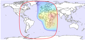
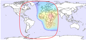
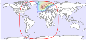
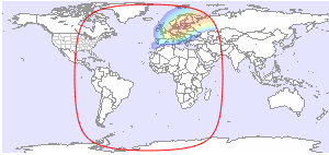
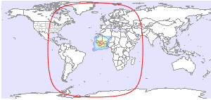
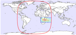
| Africa & Europe L | Africa & Europe R |
 |
 |
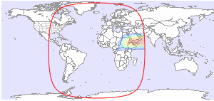
| C-band | C-band |
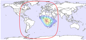
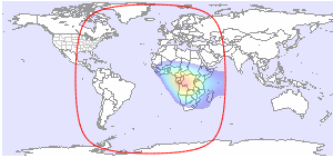
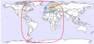
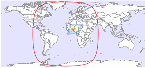
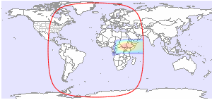
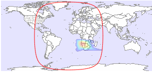
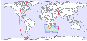
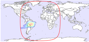
| Central Africa L | Central Africa R |
 |
 |
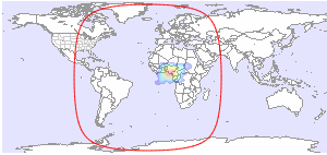
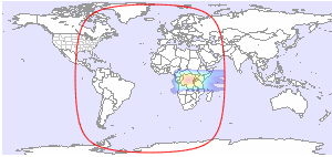
| C-band | C-band |
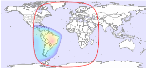
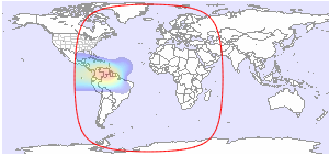
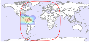
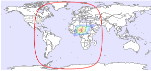
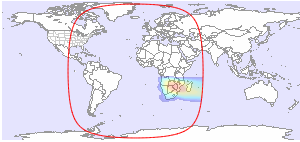
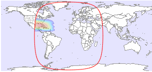
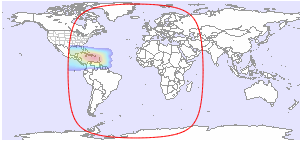
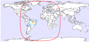
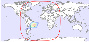
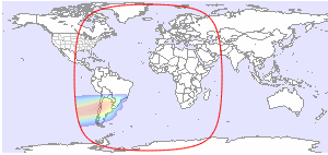
| Latin America L | Latin America R |
 |
 |
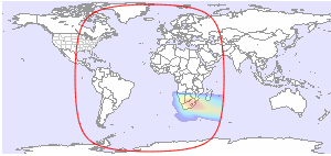
| C-band | C-band |
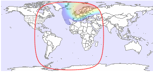
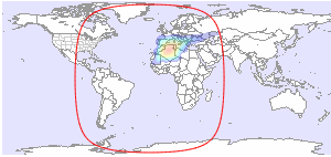
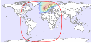
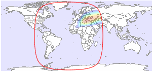
| Europe L | Europe R |
 |
 |
| C-band | C-band |
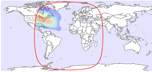
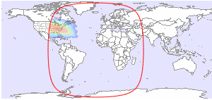
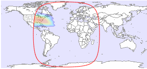
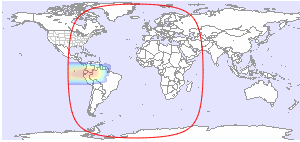
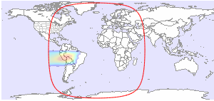
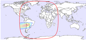
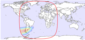
| North America L/R | South America L |
 |
 |
| C-band | C-band |
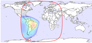
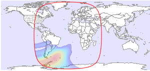
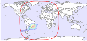
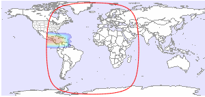
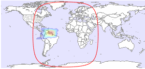
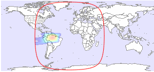
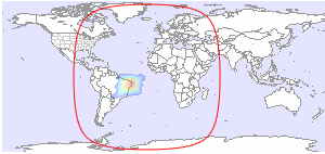
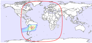
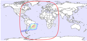
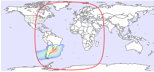
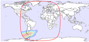
| South America R | Falkland Islands L |
 |
 |
| C-band | C-band |
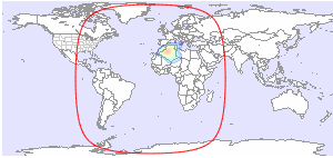
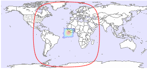
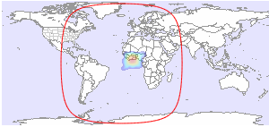
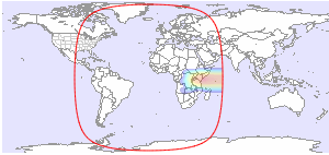
| Algeria H | Steerable Spot 1 L |
 |
 |
| Ku-band | Ka-band |
| Steerable Spot 1 R | Steerable Spot 2 L |
 |
 |
| Ka-band | Ka-band |
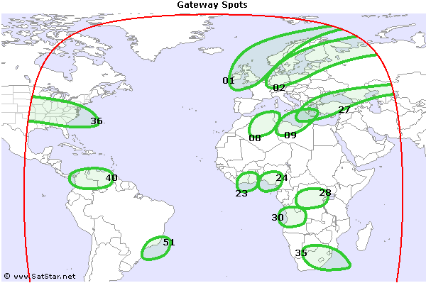
| Steerable Spot 2 R | Gateway Spot 01 H/V |
 |
 |
| Ka-band | Ku-band |
| Gateway Spot 02 H/V | Gateway Spot 08 H/V |
 |
 |
| Ku-band | Ku-band |
| Gateway Spot 09 H/V | Gateway Spot 23 H/V |
 |
 |
| Ku-band | Ku-band |
| Gateway Spot 24 H/V | Gateway Spot 27 H/V |
 |
 |
| Ku-band | Ku-band |
| Gateway Spot 28 H/V | Gateway Spot 30 H/V |
 |
 |
| Ku-band | Ku-band |
| Gateway Spot 35 H/V | Gateway Spot 36 H/V |
 |
 |
| Ku-band | Ku-band |
| Gateway Spot 40 H/V | Gateway Spot 51 H/V |
 |
 |
| Ku-band | Ku-band |
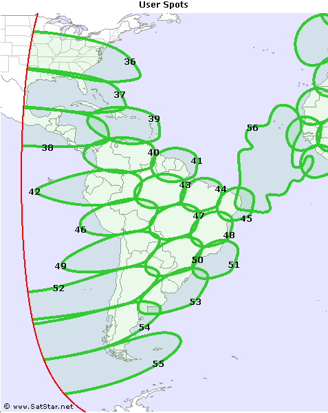
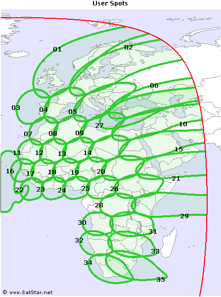
| User Spot 01 H/V | User Spot 02 H/V |
 |
 |
| Ku-band | Ku-band |
| User Spot 03 H/V | User Spot 04 H/V |
 |
 |
| Ku-band | Ku-band |
| User Spot 05 H/V | User Spot 06 H/V |
 |
 |
| Ku-band | Ku-band |
| User Spot 07 H/V | User Spot 08 H/V |
 |
 |
| Ku-band | Ku-band |
| User Spot 09 H/V | User Spot 10 H/V |
 |
 |
| Ku-band | Ku-band |
| User Spot 11 H/V | User Spot 12 H/V |
 |
 |
| Ku-band | Ku-band |
| User Spot 13 H/V | User Spot 14 H/V |
 |
 |
| Ku-band | Ku-band |
| User Spot 15 H/V | User Spot 16 H/V |
 |
 |
| Ku-band | Ku-band |
| User Spot 17 H/V | User Spot 18 H/V |
 |
 |
| Ku-band | Ku-band |
| User Spot 19 H/V | User Spot 20 H/V |
 |
 |
| Ku-band | Ku-band |
| User Spot 21 H/V | User Spot 22 H/V |
 |
 |
| Ku-band | Ku-band |
| User Spot 23 H/V | User Spot 24 H/V |
 |
 |
| Ku-band | Ku-band |
| User Spot 25 H/V | User Spot 26 H/V |
 |
 |
| Ku-band | Ku-band |
| User Spot 27 H/V | User Spot 28 H/V |
 |
 |
| Ku-band | Ku-band |
| User Spot 29 H/V | User Spot 30 H/V |
 |
 |
| Ku-band | Ku-band |
| User Spot 31 H/V | User Spot 32 H/V |
 |
 |
| Ku-band | Ku-band |
| User Spot 33 H/V | User Spot 34 H/V |
 |
 |
| Ku-band | Ku-band |
| User Spot 35 H/V | User Spot 36 H/V |
 |
 |
| Ku-band | Ku-band |
| User Spot 37 H/V | User Spot 38 H/V |
 |
 |
| Ku-band | Ku-band |
| User Spot 39 H/V | User Spot 40 H/V |
 |
 |
| Ku-band | Ku-band |
| User Spot 41 H/V | User Spot 42 H/V |
 |
 |
| Ku-band | Ku-band |
| User Spot 43 H/V | User Spot 44 H/V |
 |
 |
| Ku-band | Ku-band |
| User Spot 45 H/V | User Spot 46 H/V |
 |
 |
| Ku-band | Ku-band |
| User Spot 47 H/V | User Spot 48 H/V |
 |
 |
| Ku-band | Ku-band |
| User Spot 49 H/V | User Spot 50 H/V |
 |
 |
| Ku-band | Ku-band |
| User Spot 51 H/V | User Spot 52 H/V |
 |
 |
| Ku-band | Ku-band |
| User Spot 53 H/V | User Spot 54 H/V |
 |
 |
| Ku-band | Ku-band |
| User Spot 55 H/V | User Spot 56 V |
 |
 |
| Ku-band | Ku-band |


and TV guide data from the internet
SatStar can provide detailed technical information about commercial geostationary satellites. It can be used by professionals, e.g. for budget link calculations, and can easily be integrated into custom applications.
All data can be stored in a database, including downlink and uplink coverage maps, frequency plans, transmissions, TV/radio channels etc. For more information, please refer to the Satellite Data page.
