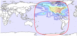
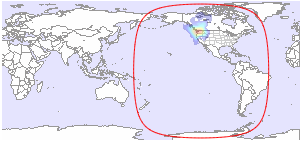
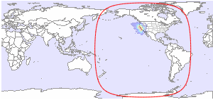
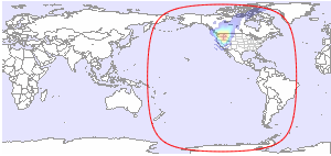
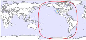
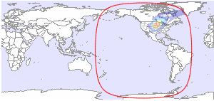
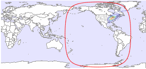
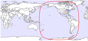
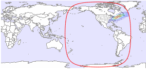
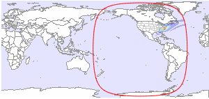
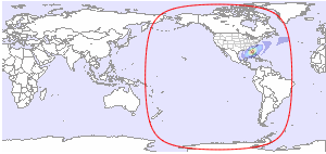
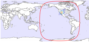
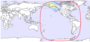
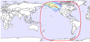
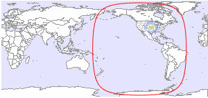
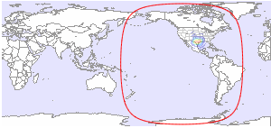
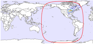
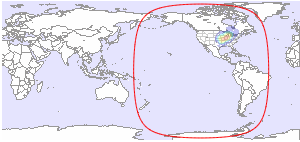
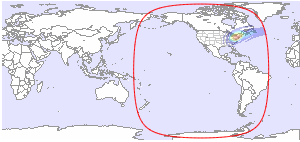
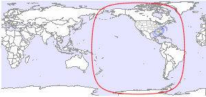
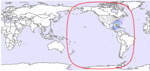
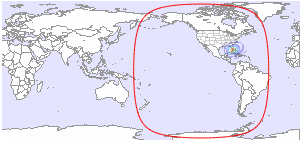
Below you will find available downlink footprint maps for EchoStar 14 at 119.0°W. Click on a map for more details. If you would like to have more technical information about TV and radio channels available on EchoStar 14, please click here.
Coverage Patterns 1
Coverage Patterns 2
Coverage Patterns 3

Coverage Patterns 4
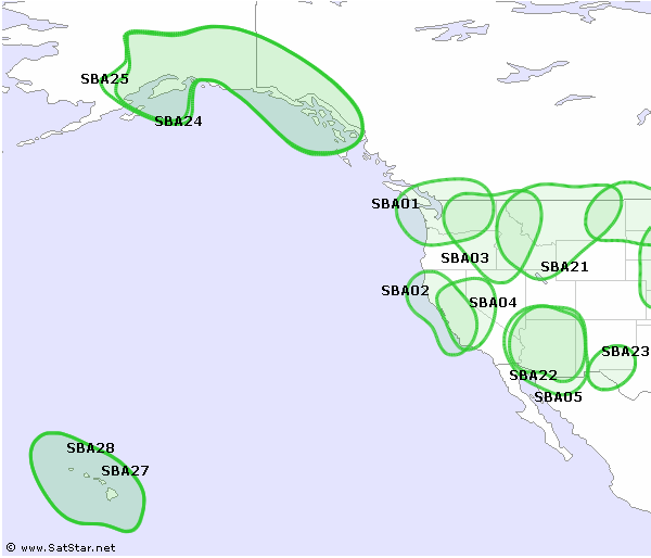
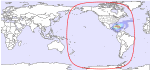
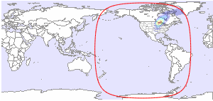
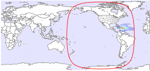
| CONUS L/R | User Spot A01 - Seattle R |
 |
 |
| Ku-band | Ku-band |
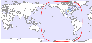
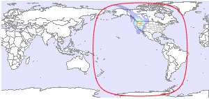
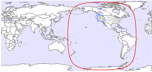
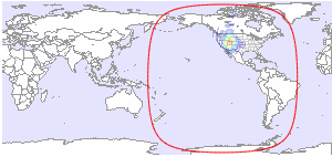
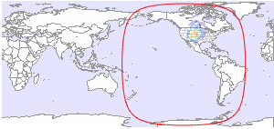
| User Spot A02 - San Francisco L | User Spot A03 - Spokane L |
 |
 |
| Ku-band | Ku-band |
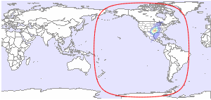
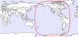
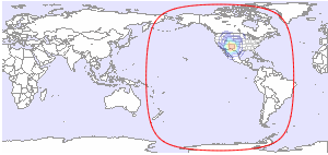
| User Spot A04 - Fresno R | User Spot A05 - Phoenix L |
 |
 |
| Ku-band | Ku-band |
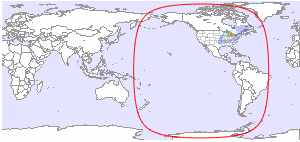
| User Spot A06 - Bismark L | User Spot A07 - Sioux Falls R |
 |
 |
| Ku-band | Ku-band |
| User Spot A08 - Kansas City L | User Spot A09 - Dallas L |
 |
 |
| Ku-band | Ku-band |
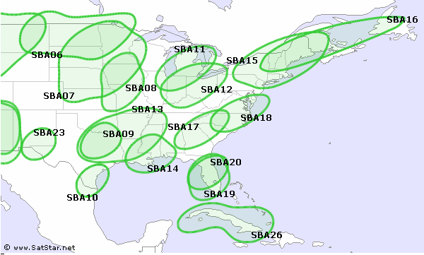
| User Spot A10 - Corpus Christi L | User Spot A11 - Lansing R |
 |
 |
| Ku-band | Ku-band |
| User Spot A12 - Columbus L | User Spot A13 - Shreveport R |
 |
 |
| Ku-band | Ku-band |
| User Spot A14 - New Orleans L | User Spot A15 - Hartford R |
 |
 |
| Ku-band | Ku-band |
| User Spot A16 - Bangor L | User Spot A17- Greenville R |
 |
 |
| Ku-band | Ku-band |
| User Spot A18 - Raleigh L | User Spot A19 - Orlando L |
 |
 |
| Ku-band | Ku-band |
| User Spot A20 - Tampa R | User Spot A21 - Butte R |
 |
 |
| Ku-band | Ku-band |
| User Spot A22 - Flagstaff R | User Spot A23 - El Paso R |
 |
 |
| Ku-band | Ku-band |
| User Spot A24 - Alaska R | User Spot A25 - Alaska L |
 |
 |
| Ku-band | Ku-band |
| User Spot A26 - Cuba R | User Spot A27 - Hawaii R |
 |
 |
| Ku-band | Ku-band |
| User Spot A28 - Hawaii L | User Spot B01 - Bend L |
 |
 |
| Ku-band | Ku-band |
| User Spot B02 - Medford R | User Spot B03 - Las Vegas R |
 |
 |
| Ku-band | Ku-band |
| User Spot B04 - San Diego L | User Spot B05 - Duluth Superior R |
 |
 |
| Ku-band | Ku-band |
| User Spot B06 - Grand Junction L | User Spot B07 - Denver R |
 |
 |
| Ku-band | Ku-band |
| User Spot B08 - Albuquerque L | User Spot B09 - Oklahoma City L |
 |
 |
| Ku-band | Ku-band |
| User Spot B10 - Houston R | User Spot B11 - San Antonio L |
 |
 |
| Ku-band | Ku-band |
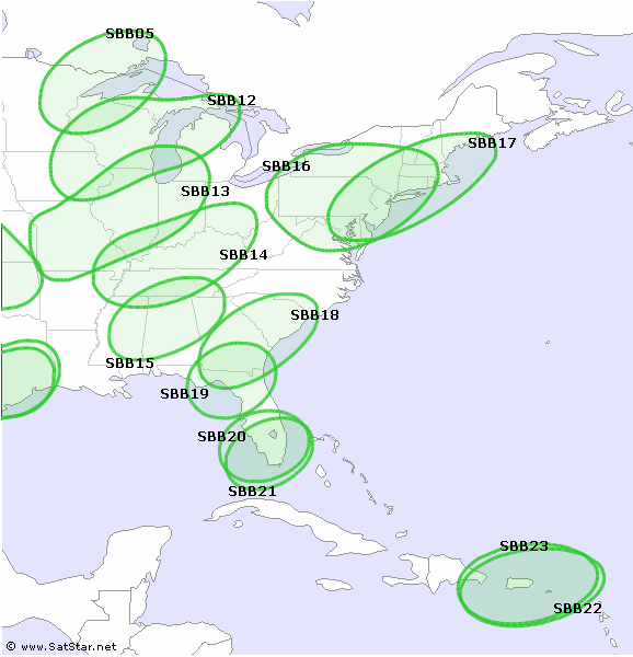
| User Spot B12 - Madison L | User Spot B13 - Springfield R |
 |
 |
| Ku-band | Ku-band |
| User Spot B14 - Nashville L | User Spot B15 - Birmingham R |
 |
 |
| Ku-band | Ku-band |
| User Spot B16 - Philadelphia R | User Spot B17 - New York L |
 |
 |
| Ku-band | Ku-band |
| User Spot B18 - Savannah L | User Spot B19 - Jacksonville R |
 |
 |
| Ku-band | Ku-band |
| User Spot B20 - Fort Meyer L | User Spot B21 - Miami R |
 |
 |
| Ku-band | Ku-band |
| User Spot B22 - Puerto Rico R | User Spot B23 - Puerto Rico L |
 |
 |
| Ku-band | Ku-band |


and TV guide data from the internet
SatStar can provide detailed technical information about commercial geostationary satellites. It can be used by professionals, e.g. for budget link calculations, and can easily be integrated into custom applications.
All data can be stored in a database, including downlink and uplink coverage maps, frequency plans, transmissions, TV/radio channels etc. For more information, please refer to the Satellite Data page.
